Vaughan’s Real Estate Media Experts
Drone Real Estate Photography in Vaughan
Aerial photography and video in Vaughan that show what a lot is really worth, from Kleinburg ravines to the VMC skyline. Flight availability depends on the address, the weather and the applicable airspace requirements.
Why Choose Odyssey3D Media
Elevated imagery. Stronger results.
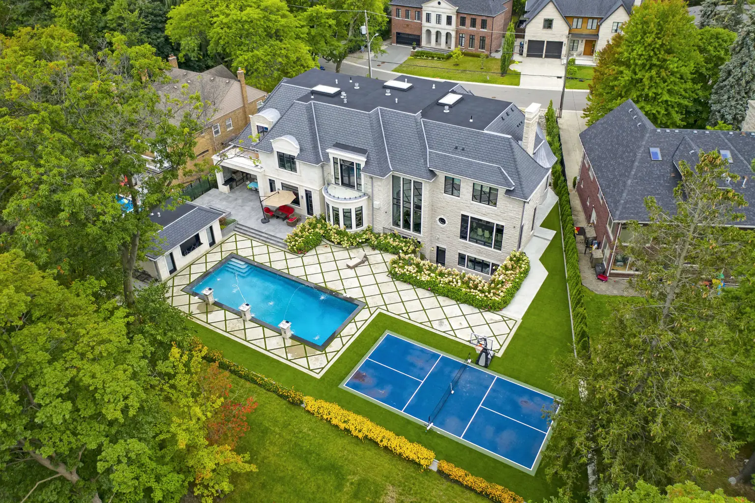
A ravine lot in Kleinburg, a pool and sport court behind a Woodbridge custom, a Patterson home backing onto parkland: the space that justifies a Vaughan price is invisible from the curb. A single aerial frame shows buyers exactly what they are paying for.
Let’s Work Together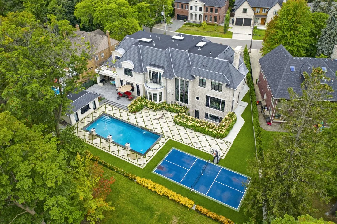
Address-first planning
Every Vaughan booking starts with the address: tower, subdivision or ravine estate, feasibility is reviewed before we confirm.
Stills and video that carry scale
High-resolution aerials hold detail across wide estate lots and 55-storey sightlines alike.
Next business day photos
Edited aerial photos arrive the next business day, ready for MLS and launch.
The lot tells the story
Frontage, ravine, park edge and street pattern in a single frame buyers instantly read.
Flight Coverage
Vaughan properties. Planned from above.
Every address gets a flight plan built around its strongest selling point, from ravine frontage to estate acreage, subdivision lot lines or the VMC skyline.
Kleinburg
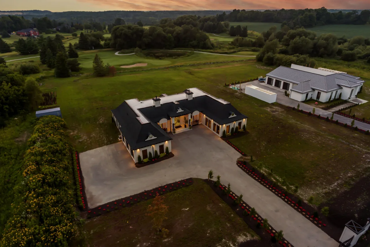
Ravine estate
Wide passes follow the valley treeline and place the home against its ravine setting.
VMC
Skyline condo
Exterior and skyline movement connects the suite to the Festival and Transit City towers around it.
Vellore Village
Detached home
The approach, the frontage and the street pattern give buyers scale before the first showing.
Woodbridge
Executive custom
Top-down and oblique angles reveal landscaping, pool, sport court and mature canopy.
Local Experts. Local Perspective.
Proudly serving Vaughan
Parts of Vaughan sit near Toronto Pearson’s arrival and departure paths, and the area around Canada’s Wonderland brings its own considerations, so we plan every shoot around the specific address, the weather and the applicable airspace requirements.
Simple, Transparent Pricing
Choose the perfect package
Aerial coverage comes included in LEGENDARY PLUS, and it can be added to any other package or booked on its own. See the full pricing page for every package, every home size and every add on price in one place.
Simple Process. Stunning Results.
Our 3 step process
We make it easy to showcase your property from above with a clear flight plan and reliable delivery.
Book and address check
Pick a time at order.odyssey3d.ca. We review the address, weather and flight feasibility before the shoot.
We capture the aerial shots
Our team captures the planned aerial angles when the address and weather allow.
Delivered next business day
Edited aerial photos arrive next business day. Aerial video timing is confirmed with your selected package.
Local Experts. Local Perspective.
The Vaughan aerial photography team realtors call first
What We Offer
More than aerials.
A complete media solution.
From immersive 3D tours to photography and cinematic video, we shoot everything you need to present a property properly.
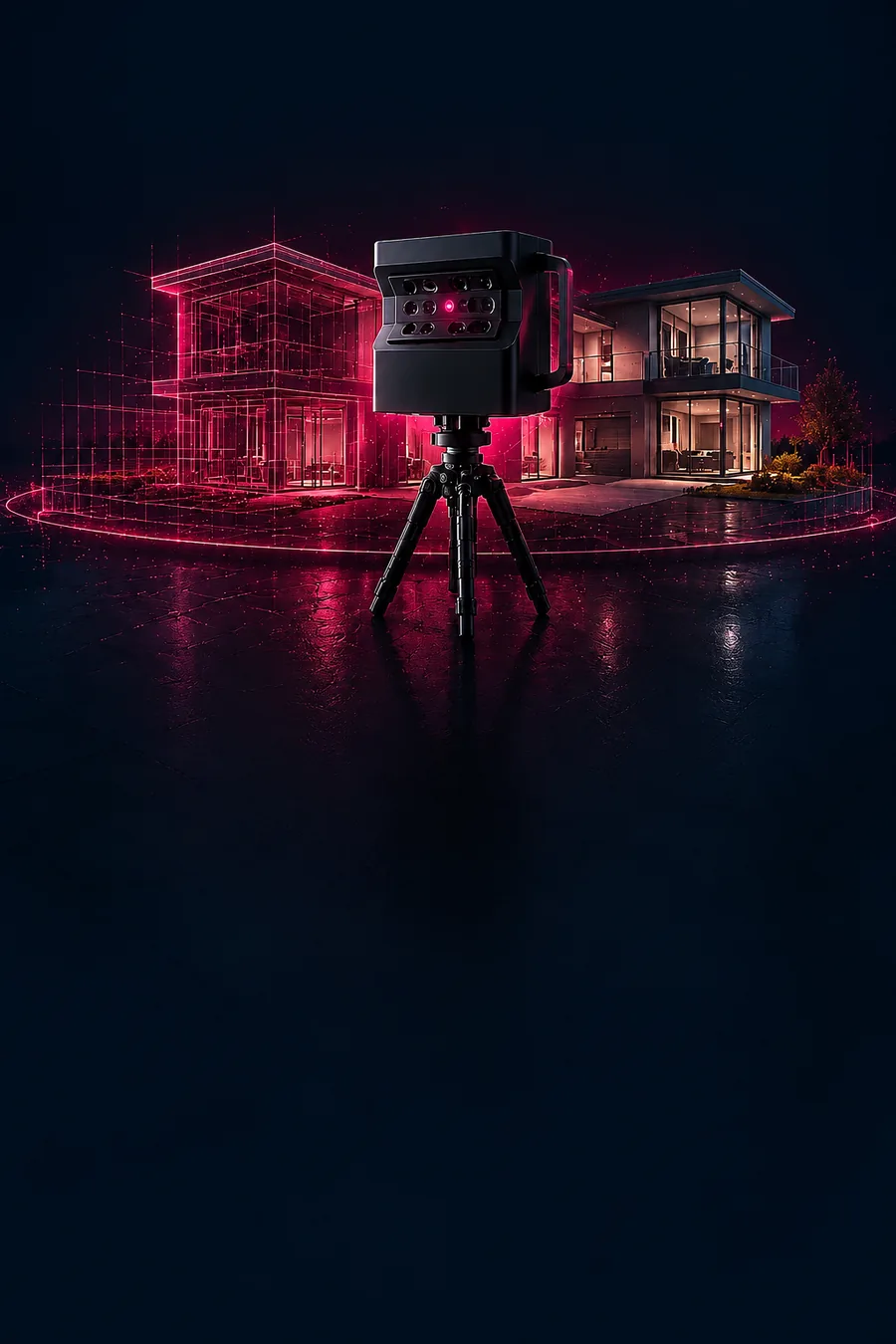 Immersive 3D Tours
Matterport 3D tours that let buyers explore every space, anytime, anywhere.
Explore in 3D
Immersive 3D Tours
Matterport 3D tours that let buyers explore every space, anytime, anywhere.
Explore in 3D
Tell us about the property
Get 10% off your first Vaughan shoot
First time with us? Your first shoot is 10% off. Send the address and what you need covered, from Kleinburg estates to Vaughan Metropolitan Centre towers, and we will plan the flight around the light and the airspace.
Next business day deliveryTiming locked in before you book
(416) 884-2167Call or text, we answer
hello@odyssey3d.caEmail whenever suits you
The Short Answer
When do drone photos add value to a Vaughan listing?
Aerial photos are strongest for ravine and valley lots in Kleinburg and Woodbridge, estate properties with pools, courts and mature landscaping, newer builds in Vellore Village and Patterson where lot position matters, and condo towers at Vaughan Metropolitan Centre where the skyline is the story. Aerials give buyers spatial context that ground photos cannot, and they complement rather than replace interior HDR photos.
01
Aerial photography and drone videography in Vaughan
Aerial stills anchor the MLS gallery, while a short aerial video sequence shows the approach and the setting in motion and cuts into the main listing film. Drone video and photos are available together as one package. Pair aerials with real estate photography in Vaughan, a cinematic real estate video in Vaughan or a Matterport 3D virtual tour in Vaughan, and see drone photo and video pricing for the full range.
02
Flight planning around Vaughan airspace
Vaughan sits north of Toronto Pearson, and parts of the city fall near its arrival and departure paths, while the blocks around Canada’s Wonderland come with their own planning considerations. In practice that means flight availability depends on the address, the weather and the applicable airspace requirements, and a few locations are better suited to elevated pole or twilight exterior coverage instead. Explore the full drone real estate photography service, or check drone availability for your address before you book.
FAQ
Questions? We’ve got answers.
Everything you need to know about drone real estate photography in Vaughan.
Fast turnaroundPhotos next business day
Address checkedFlight feasibility reviewed
Professional aerialsHigh-resolution photos and video
5.0 Google ratingBased on 161 Google reviews
Call or text +1 416-884-2167 and tell us about the listing, or book your shoot online.
Is drone photography even allowed in Vaughan?
Often yes, but it always comes down to the specific property. Parts of Vaughan sit near Toronto Pearson’s arrival and departure paths and the area around Canada’s Wonderland has its own considerations, so flight availability depends on the address, the weather and the applicable airspace requirements. Book online and our team reviews the location before confirming aerial coverage.
What do aerials add for a Vaughan listing?
Lot context. A Kleinburg ravine lot, a Patterson home backing onto a park, or a Concord property minutes from Canada’s Wonderland and Vaughan Mills reads instantly from 100 feet up in a way ground photos cannot show.
When is the best season for drone shots in Vaughan?
Late spring through fall for greenery, though winter aerials work well for manicured estates. We watch wind and precipitation, and if a flight day is unsafe we reschedule at no charge rather than deliver shaky footage.
Are drone photos worth it for a Vaughan listing?
They are strongest for ravine and estate lots in Kleinburg, Woodbridge and Islington Woods, larger properties in Vellore Village and Patterson, and any listing where lot size or setting is part of the sell. A small interior condo usually benefits less. Pair them with real estate photography in Vaughan, cinematic real estate video in Vaughan or Matterport 3D virtual tours in Vaughan.
What if the weather is bad on shoot day?
High wind or rain can prevent safe aerial capture. If a Vaughan flight day is unsuitable, we reschedule to the next workable window and confirm revised timing.
What is the difference between drone photos and drone video for a listing?
Aerial photos are still images that show the lot, roofline and surroundings for the MLS gallery. Aerial video shows the approach and setting in motion, which suits long Kleinburg driveways and estate frontage, and works best cut into a cinematic listing video. Many listings use both, and drone video and photos are available together as one package.
Can drone photos show the property lines or lot size?
Aerial photos show the shape, size and surroundings of a lot and how it sits against ravine, park or street, which helps buyers understand scale. They are marketing images, not a legal survey, so they do not replace a surveyor’s property lines.

Ready to Elevate Your Listing?
Let’s capture it from above.
Show the whole lot, not just the rooms. Book your Vaughan aerial shoot.

Toronto’s real estate media experts. Cinematic. Strategic. Built to sell.
More ways to market your Vaughan listing
Real Estate PhotographyMatterport 3D Virtual ToursReal Estate Videography10% OFF Your First Shoot
A local team for every Vaughan neighbourhood.
Get 10% off your first shoot with us. We shoot across Woodbridge, Kleinburg and Maple every week. Tell us where the listing is.